jason@fly-TCA.comService Area: Tri-Cities

Tri-Cities Aerial Solutions · Bristol TN/VA

See More.
Know More.
Do More.

Commercial aerial imaging, mapping, thermal observation and property documentation for owners, construction teams and real estate professionals across the Tri-Cities.

Request a Quote

FAA Part 107 commercial operator · Johnson City · Kingsport · Bristol

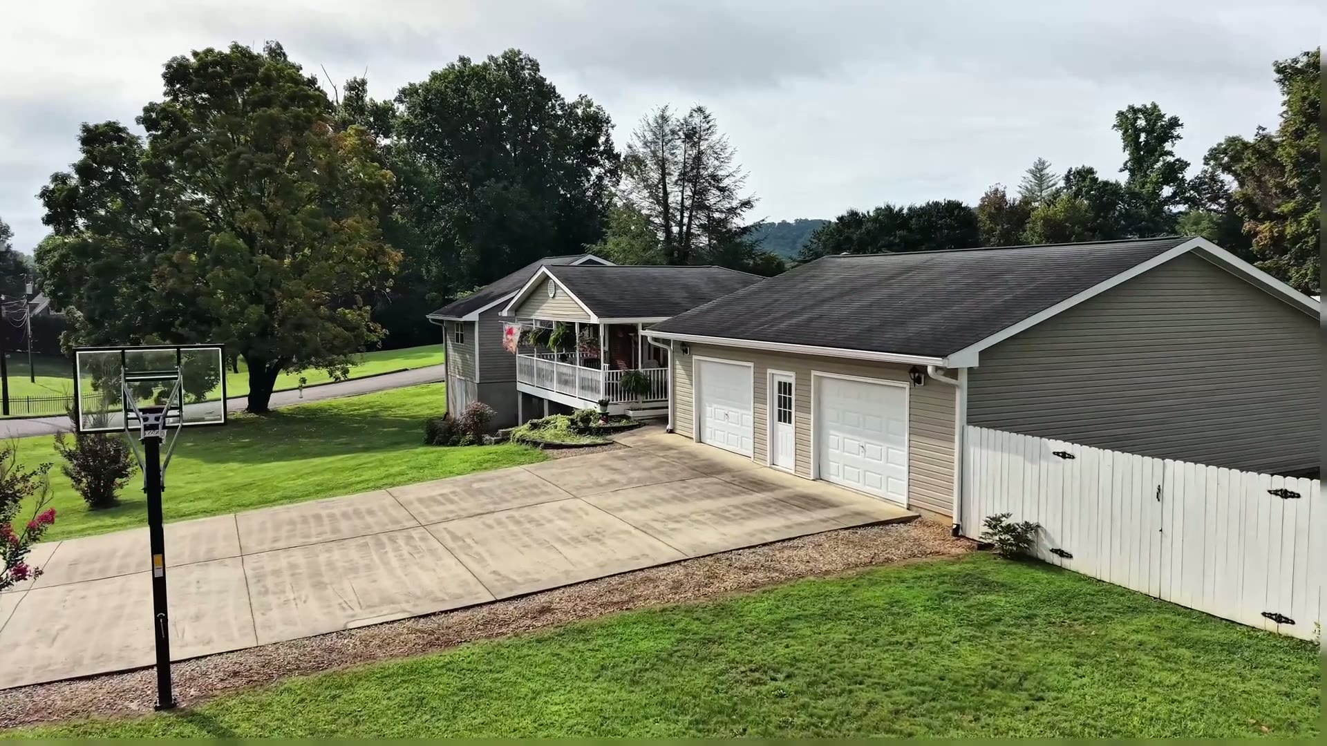
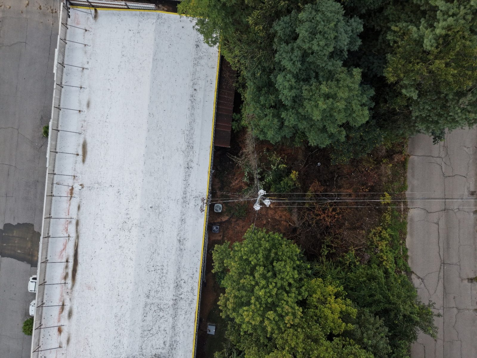
Actual T-CAS commercial roof and adjoining property aerial documentation

Tri-Cities Aerial Solutions / Commercial Property Intelligence

Your Property.

A smarter way to manage, inspect, and protect.

You don’t have to be on site to stay informed. Aerial observations, thermal screening and mapping give absentee commercial owners a clearer record of their property.

Observation, documentation and owner-authorized coordination—not licensed property management, surveying or engineering. Thermal findings require qualified follow-up.

Proposed recurring service levels

Choose the depth of your view.

Start with your property, priorities and reporting needs. We’ll define a practical observation and delivery scope together.

Indicative starting rates / subject to scope. Proposed service levels—not contractual prices.

01 / Proposed level

Property Watch

$695/mo

Indicative starting rate · Subject to scope

A consistent visual record.

  • Proposed recurring visual observations
  • Exterior and access-area photography
  • Contractor activity documentation
  • Organized photographic reporting

Not included

  • – Thermal screening
  • – Orthomosaic or 3D mapping
  • – Vendor coordination
  • – Property management or repairs

Example only: about one exterior visual visit per month on a single site of a few acres.

Discuss Property Watch
02 / Proposed level

Property Intelligence

$1,495/mo

Indicative starting rate · Subject to scope

More context. Better-informed decisions.

  • Everything in Property Watch
  • Scoped Matrice 4T thermal anomaly screening
  • Scoped Matrice 4E site mapping
  • Repeat-observation comparisons

Not included

  • – Vendor coordination
  • – Unscoped extra visits or flights
  • – Owner record program
  • – Engineering or survey findings

Example only: monthly visual visits plus thermal and mapping at an agreed interval, such as quarterly.

Discuss Property Intelligence

03 / Proposed level

Property Intelligence 360

$2,495/mo

Indicative starting rate · Subject to scope

A broader view of your property.

  • Everything in Property Intelligence
  • Coordinated multi-modal visual, thermal and mapping program
  • Orthomosaic, 3D context and contractor progress records
  • Owner record concept with secure historical deliverables

Not included

  • – Unlimited visits or on-demand response
  • – 24/7 attendance
  • – Operational owner portal
  • – Property management, leasing or repairs

Example only: a mutually agreed multi-visit schedule; exact cadence is set in writing.

Discuss Property Intelligence 360

Visit frequency, property size, access, airspace, thermal conditions, mapping requirements and reporting depth determine final scope and pricing. No specific visit schedule or response time is promised. Thermal screening does not guarantee roof moisture detection or diagnose defects; surveying and engineering decisions remain with qualified licensed professionals. Property Watch is visual monitoring only and is not property management.

  • Each level includes only its written allowance; work outside it is quoted separately.
  • Standalone project flights are discrete deliverables, not a substitute for a monthly level.
  • Overlapping booked work is credited or bundled, never billed twice. Discounts do not automatically stack.
  • Visit counts, site size and timing shown are examples only, not commitments. Exact cadence is mutually agreed.

Real output, not mockups

Deliverables you can actually use.

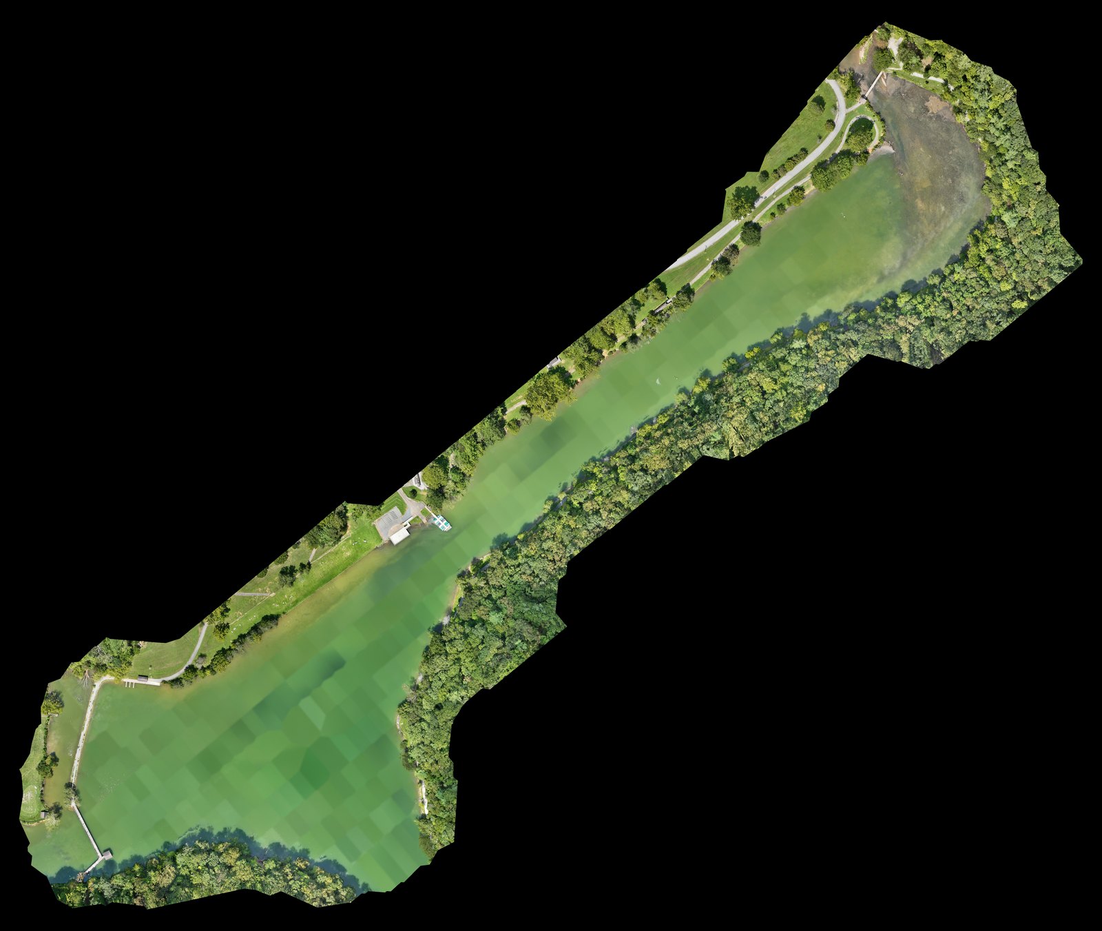
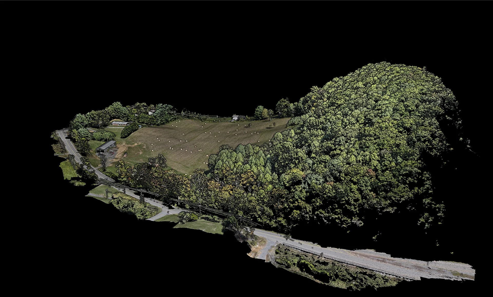
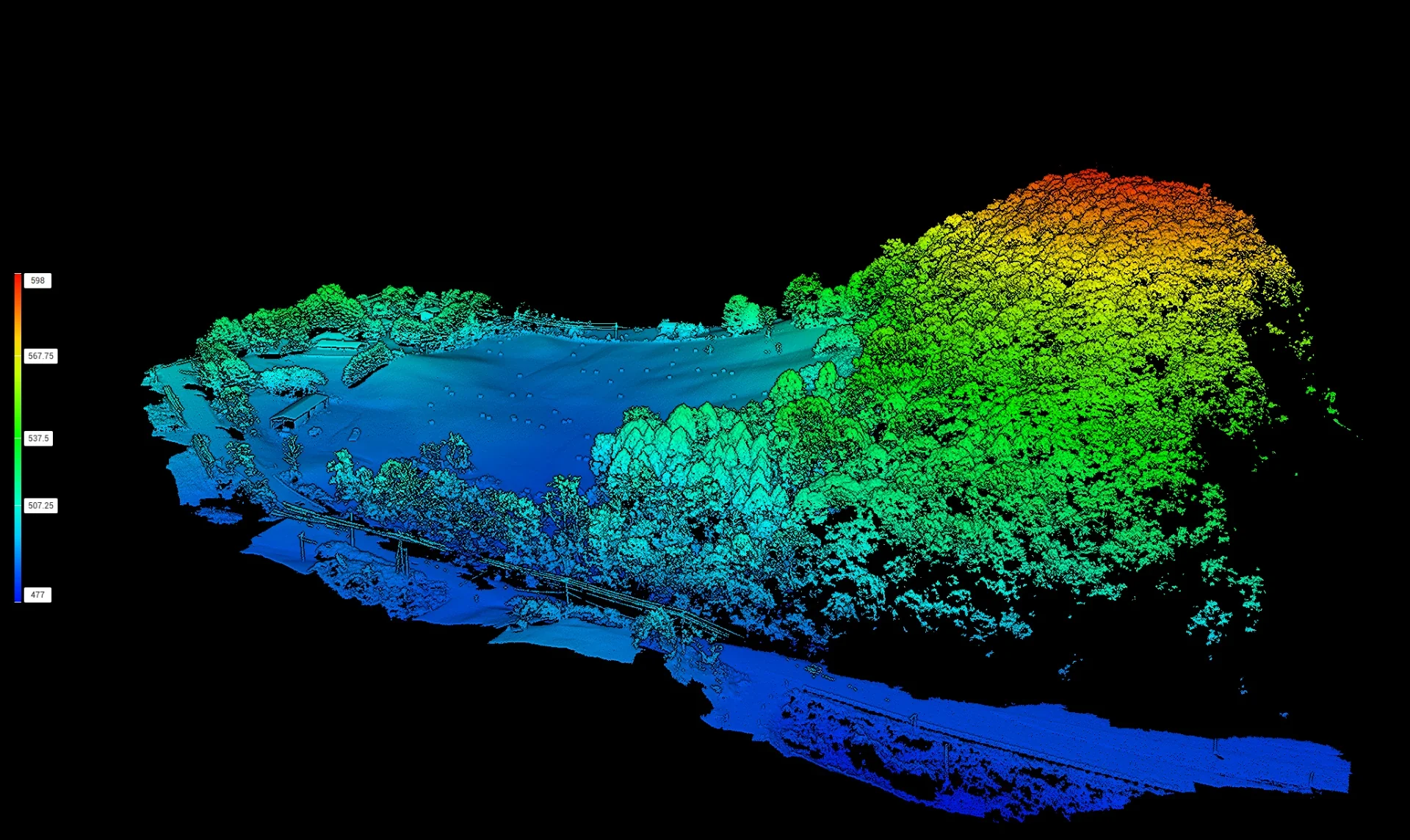
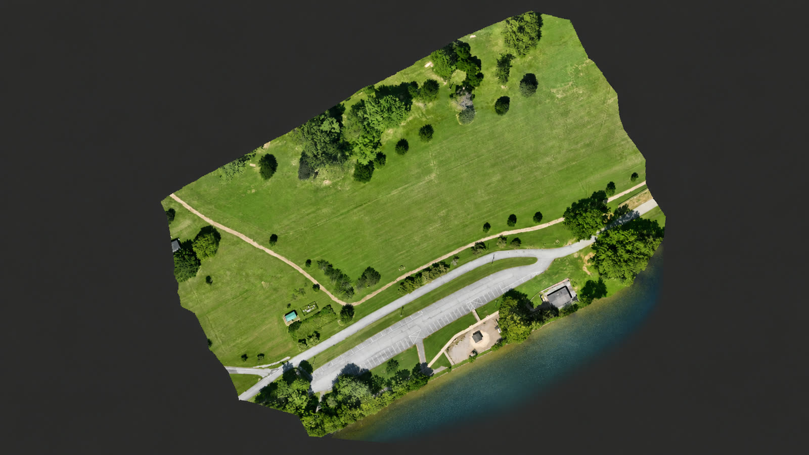
Orthomosaics, 3D reconstructions and elevation context processed in-house from actual T-CAS flights. Demonstration projects are labeled; client work is delivered privately.

Actual T-CAS orthomosaic of Steele Creek Park produced from Matrice 4E imagery
Orthomosaic / Steele Creek ParkDemonstration project
Public T-CAS demonstration of a textured 3D site reconstruction
3D reconstruction / Anonymized demoAnonymized demonstration
Public T-CAS demonstration of an elevation visualization derived from aerial mapping
Elevation context / Anonymized demoAnonymized demonstration

Interactive web maps with parcel overlays and organized report archives are delivered through private, passcode-protected client access — client presentations are never published as public demos. Public demonstrations: Steele Creek Park and the anonymized mapping capabilities walkthrough.

Why Tri-Cities Aerial Solutions

Purpose-built capability. Local accountability.

The right aircraft and processing workflow for each job — with client-ready mapping and report delivery at the end of every engagement.

  • FAA Part 107 operator

    Commercial flights conducted under FAA Part 107 remote pilot certification.

  • Matrice 4E mapping

    Primary aircraft for georeferenced orthomosaics and 3D site reconstruction.

  • Matrice 4T thermal

    Radiometric thermal anomaly screening and stand-off visual observation.

  • Mini 5 Pro visual

    Visual property monitoring and photographic progress records.

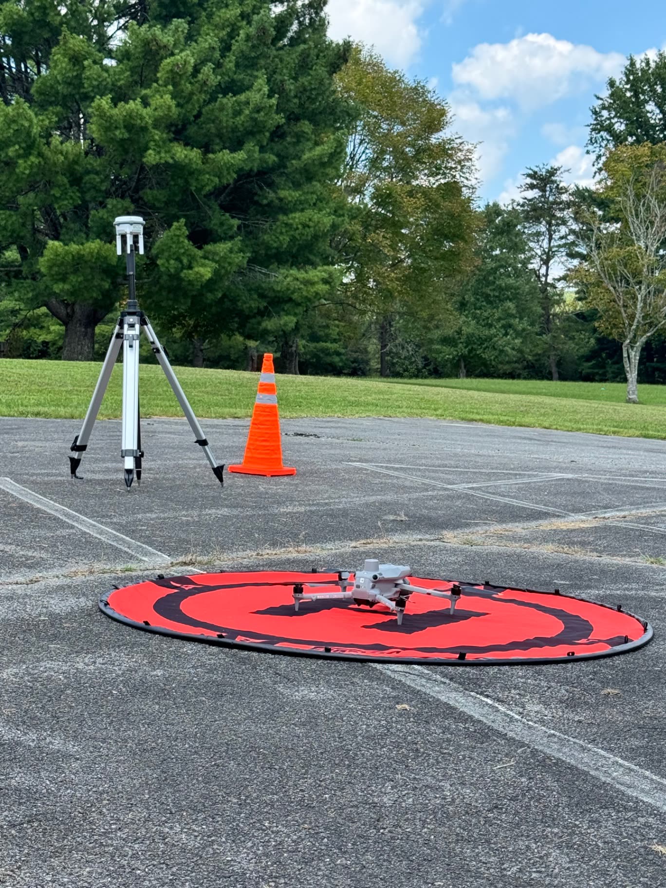
  • D-RTK 3 corrections

    On-site corrections support consistent, repeatable mapping observations.

  • In-house processing

    Imagery processed and delivered by the same local team that flies it.

Aerial mapping and thermal screening are observation and documentation tools. Thermal anomalies are indicators for further evaluation, not by themselves a diagnosis of a defect. Final diagnosis and repair decisions belong to the relevant qualified trade or professional.

Built on Experience. Driven by Innovation.

“A man who spent years building businesses with his hands and is now building his future with technology — without abandoning either.”

We believe the future belongs to businesses that combine real-world experience with modern technology. That’s the foundation of everything we’re building.

The Vision Behind Tri-Cities Aerial Solutions

Ready when you are

Put your property
in clearer view.

Tell us the property, the site or the project. We return a written scope and quote — typically within one business day.

Bristol TN/VAMapping · Thermal · Progress · ImageryPrivate client delivery